

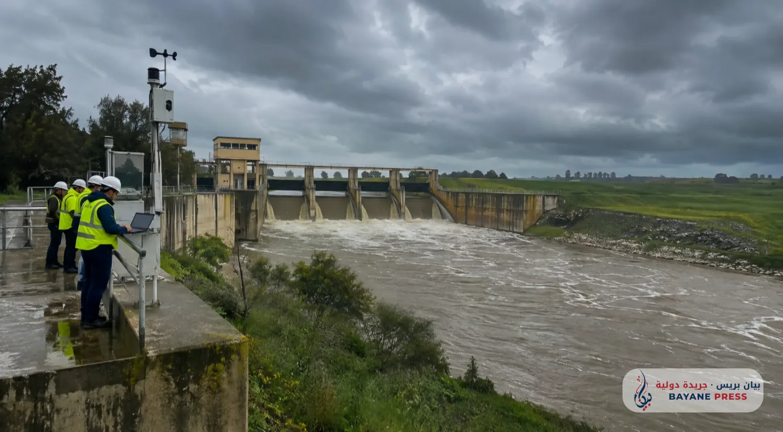
Moroccan authorities are moving to strengthen the flood prevention system in the Gharb plain through a proactive technical program overseen by the Sebou Basin Agency. This initiative includes creating precise maps of flood-prone areas, developing early warning mechanisms, and improving the management of dams and water infrastructure, in light of the challenges posed by climate volatility and the increased risk of exceptional rainfall.
Data published on Friday, November 13, 2026, based on a memorandum from the Sebou Basin Agency, revealed that the agency intends to launch a study in 2027 to create an atlas of flood-prone areas in the Gharb plain, in addition to preparing a flood risk prevention plan, with a total budget of 12 million dirhams.
This step is part of a strategy aimed at shifting from post-disaster intervention to adopting preventive measures based on hydrological data and climate forecasts, allowing for the identification of the most vulnerable areas and improving decision-making speed when exceptional water level rises are recorded.
Regarding dam management, the agency reported that an additional storage capacity of approximately 850 million cubic meters has been secured at the Al Wahda dam, and 400 million cubic meters at the Idriss I dam, by maintaining empty space within their reservoirs to accommodate potential water inflows and mitigate flood waves.
The measures also include the development of an early flood forecasting platform based on three interconnected systems: the first estimates water inflows and expected flow rates, the second monitors areas potentially subject to flooding, and the third assists in simulating dam management scenarios, providing competent authorities with technical tools for appropriate decision-making.
The measures also included inspections of the readiness of water facilities and discharge equipment, and the reinforcement of technical teams overseeing dam management, particularly Al Wahda, Idriss I, El Kansera, and Allal El Fassi, in addition to cleaning sections of the Oued Rdem and removing sediments that could impede water flow.
Regarding water projects, the data confirmed that the Sidi Abbu dam, located on the Oued Lebene, has entered the operational phase, while the progress rate of the R'tba dam has reached 60 percent, compared to 35 percent for the Rabat El Kheir dam.
The programmed projects also include the construction of the Bab Ouender dam with a storage capacity of 350 million cubic meters, and the raising of the Bouhouda dam to increase its capacity to 600 million cubic meters, as part of a program extending to the end of 2027.
The importance of these measures is highlighted by the geographical characteristics of the Gharb plain, which hosts vast agricultural areas, population centers, and infrastructure that could be affected by rising water levels. However, the effectiveness of these measures will remain linked to the speed of project implementation, the accuracy of weather forecasts, and continued coordination between institutions responsible for water resource management, civil protection, and territorial authorities.

Comments (0)
No comments yet. Be the first to react!